Brace yourself.
The odds of a cataclysmic 7.0 earthquake erupting along the deadly San Andreas fault have shot up dramatically – to just 1-in-5 in the next 30 years, according to the U.S. Geological Survey.
New information released by the USGS and others reveals that recent swarms of earthquakes near the Salton Sea have a strong likelihood of reigniting that portion of the San Andreas fault – which, normally ruptures every 250 years and has lain dormant since the 1680s.
This sleeping giant, once stirred from dormancy, could spark other major quakes in more populated areas of Los Angeles, Orange County and farther up the coast, experts have determined.
This has prompted the USGS to reassess its earlier calculations for risk to the area.
In August, it increased the chance of a magnitude 7 earthquake along the San Andreas 100 times over: to 1 in 100 in any given week compared to the previous 1 in 10,000 chance cited by the agency.[i]
The San Andreas fault is notorious for committing some of California’s most devastating and deadly quakes, including the 1906 San Francisco, 1989 Loma Prieta, 1971 Sylmar, and 1994 Northridge disasters.
That’s just small sampling of megaquakes that have struck in the last century, but the story doesn’t end there.
This deep divide called the San Andreas, stretching 750 miles from Eureka in the north to the Gulf of California in Mexico, has a history of cataclysmic temblors: The 1857 Fort Tejon quake (7.9 magnitude), erupted along 225 miles from the Cholame Valley to Wrightwood; the San Francisco quake of 1838 (7.4); quakes in 1881 in Los Angeles (7.1) and Wrightwood (7.3); the 1800 quake of San Diego (6.3); and the 1700 quake of Mendocino (9.0).[ii]
Geological studies point to many more mammoth temblors long before California’s recorded history.
Moving at a rate of about 2 inches per year, the San Andreas has slipped a total of about 220 miles since it began moving about 28 million years ago, according to the USGS.[iii]
Geologists are able to detect significant ground movement before the recorded history of time by examining the shift in rock formations that provide clues to the time of the earth movement and its force.
Some of these findings indicate significant earthquakes of 7.0 or larger over the past 1,000 years in California. These include the following pre-1800 events and their approximate years[iv]:
- Coachella Valley, (840-1150), (1170-1290), (1450-1555), (1520-1680)
- Fremont, (1360-1580), (1530-1740), (1650-1790)
- Imperial Valley, (1670)
- Kern County, (1030-1460)
- Marin County, (1050-1450), (1100-1330), (1520-1690)
- Palmdale, (1031-1096), (1046-1113), (1343-1370), (1460-1600), (1496-1599)
- Point Arena, (680-1640), (1040-1640)
- Redding, (1020), (1230), (1290), (1360), (1630), (1760).
- Sacramento County, (1020-1610), (1430-1670)
- San Bernardino, (1450), (1630), (1690)
- San Luis Obispo, (1218-1276), (1277-1510), (1405-1510)
- Ventura County, (780-1130), (1120-1350), (1450-1600)
- Wrightwood, (1047-1181), (1191-1305), (1448-1578), (1508-1569), (1647-1717)
By comparison, California quakes measuring 6.0 or higher during a 200-year span from 1800 to 2019 include[v][vi]:
- Big Bear, (1992, m.6.5)
- Borrego Springs, San Diego County, (1954, m.6.3), (1968, m.6.6)
- Calaveras, (1864, m. 6.1)
- Desert Hot Springs/Palm Springs, (1948, 6.0), (1986, m.6.0)
- Eureka, (2010, m.6.5)
- Fort Bragg/Mendocino, (1989, m.6.7), (1992, m.6.6, 6.5, and 7.2)
- Fort Tejon, (1857, m.7.9)
- Gilroy, Santa Clara County, (1897, m.6.3)
- Imperial Valley, (1875, m.6.2), (1906, m.6.2), (1940, m.7.0), (1979, m.6.5), (1989, m.6.6)
- Loma Prieta, (1989, m.6.9)
- Mare Island, Solano County, (1989, m.6.4)
- Mojave Desert, (1992, m.7.3), (1999, m.7.1),
- Morgan Hill, Santa Clara County (1984, m.6.2)
- Napa, (2014, m.6.0)
- Northridge, (1994, m.6.7)
- Pajaro Gap, San Benito County, (1890, m.6.3)
- Parkfield, Monterey County, (1881, m.6.0), (1901, m.6.4), (1922, m.6.3), (1934, m.6.0), (1966, m.6.0), (2004, m.6.0)
- Ridgecrest, (2019, m.7.1 and 6.4)
- San Francisco Bay Area, (1838, m.7.4), (1864, m.6.1), (1868, m.7.0), (1906, m.7.8),
- San Jacinto, Riverside County, (1890, m.6.8), (1897, m.6.5), (1899, m.6.7), (1918, m.6.8), (1923, m.6.2)
- San Jose, (1911, m.6.4)
- San Simeon, (2003, m.6.6)
- Wrightwood, (1812, m7.5)
Present day threats are grim
Based on this and other historical and geological data, California is positioned to continue suffering the blows of major seismic events, probably until the end of time.
Paleoseismologists from the Nevada Bureau of Mines and Geology at the University of Nevada, Reno, expect the continual shifting of tectonic plates will shape an entirely new landscape, but none of us will be around to see it.
California won’t fall into the ocean, they said, but it could get nudged hundreds of miles offshore, making Nevada the new coastline of the continent in another 7 million years or so.[vii]
Today, a rise in seismic activity, recorded in swarms such as mentioned above, is giving rise to new concerns among scientists that pressure along the San Andreas and neighboring faults is mounting and could eventually explode into a seismic force of epic proportions.
We are now learning that major earthquakes are most often sparked by smaller occurrences.
California’s last megaquake, a magnitude 7.9 in 1857, was on the San Andreas fault in Fort Tejon and – true to history – was preceded by smaller quakes nearby, the Los Angeles Times reported:
“The first quakes came about nine hours before the magnitude 7.8. Then, two hours before the Big One hit, a magnitude 6.1 quake struct, and an hour before the main event, a magnitude 5.6 quake hit. It started in Monterey County but rushed down to Los Angeles County in about two minutes, sinking trees in Sacramento and uprooting trees near the Grapevine section of Interstate 5.”[viii]
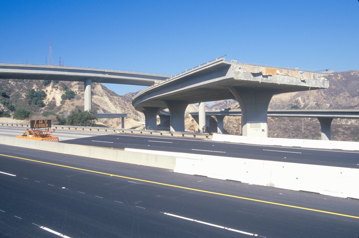
Damage then was limited – because California had not yet acquired the immense, multi-layered infrastructure of concrete, brick and steel that makes up the bulk of our cities today.
How ready are we for the next major seismological event?
If that quake were to strike today, one in every 16 buildings – some 300,000 structures – in the Greater Los Angeles region would be damaged, the United States Geological Survey determined. And the odds of a massive quake striking are much more likely than one may suspect. The USGS estimated in the mid-2000s that there was a 99% chance in the next 30 years of another Northridge-size earthquake occurring in California.
This prediction came true with the Ridgecrest earthquakes of 2019.
Today, the California Earthquake Authority places similar odds on it happening again, saying there is a more than 99% chance of an earthquake as large or larger than Northridge striking the state[ix]. (The Northridge quake, measuring 6.7 on the Richter scale, damaged or destroyed more than 82,000 structures, killed 60 people, and injured 9,000 in 1994.)[x]
Even more dramatic is the 45% likelihood of a major quake of magnitude 7.5 or greater in the next 30 years. A quake of that size is projected to cause widespread devastation with recent estimates putting damages caused by a magnitude-7 earthquake on the Puente Hills fault running through downtown Los Angeles at more than $252 billion with thousands killed and hundreds of thousands displaced.[xi]
What do the recent swarms mean for Southern California?
An earthquake swarm refers to a sequence of seismic events that occur in the same general area within a given period of time, ranging from days to months, or even years, with no major mainshock to trigger them.
A recent earthquake swarm near the Salton Sea – measuring up to magnitude 4.6 – prompted the USGS last month to warn in August that the region has a “significantly greater” probability of larger earthquakes than usual. (Swarms in the area are happening with growing frequency, most recently in 2001, 2009, 2016 and again in 2020.)
The agency predicted a 20% chance of a larger earthquake between 5.5- to 6.9-magnitude to strike the area in the coming days. It also warned of a 1% chance that a megaquake of 7.0 or larger could occur.[xii]
Seismic activity of just about any kind will increase earthquake risks because it elevates the overall earthquake frequency on a fault, USGS scientists explain. Activity on smaller faults that cross the San Andreas can set it off.[xiii]
That happened in 1987, when a swarm activity straddling California’s Superstition Hills fault triggered an earthquake on the larger fault.[xiv]
Earthquake swarms, believed to be associated with fracking, have also been prevalent in Oklahoma, which has seen a sizeable uptick in seismic activity in recent years. Between 1972 and 2008, the USGS recorded just a few earthquakes in the state. In 2008, there were more than a dozen. The following year, nearly 50 occurred, and in 2010 the number exploded to more than 1,000.[xv]
In a state where the earth is not supposed to move, Oklahoma in 2016 experienced its largest earthquake ever – a 5.6-magnitude jolt that scientists link to the surge in seismic activity there.[xvi]
Earthquake swarms in Europe have also raised concerns.
The 2009 L’Aquila earthquake in Italy was a 6.3-magnitude temblor that followed a swarm of quakes measuring between 1 and 3 in magnitude. In an inquiry following the disaster, seven members of the Italian National Commission for the Forecast and Prevention of Major Risks were accused of covering up the danger of the swarm prior to the major quake. In 2012, six scientists and one former government official were convicted on multiple manslaughter charges for downplaying the likelihood of the quake. Those convictions were later overturned.[xvii]
The importance of being prepared
Researchers at U.C. Berkeley and Stanford University believe earthquakes may have wiped out some of the world’s great ancient communities, including the Mayan civilization (800 A.D.); city of Troy (1200 B.C.); Megiddo, also known as Armageddon (1468 B.C.); and the Harappan civilization of South Asia (1900 B.C.).
It’s not the quakes themselves that cause death and destruction – it’s inferior building stock.
Structures with questionable seismic resistance – those that are proven to be vulnerable to seismic shaking – pose a real threat to our communities, to our neighbors, even our own families.
We are all familiar with the twisted, steel frame buildings and collapsed soft-story Northridge Meadows apartment buildings that took16 lives in that 1994 earthquake. Other fallen structures took their toll as well: The 6.7 magnitude jolt killed more than 60 people, injured more than 9,000 and caused as much as $25 billion in widespread damage.
There are four major strikes against California that put it at risk for earthquake damage, the California Office of Emergency Services said[xviii]:
- Its geography and location along the infamous “Ring of Fire” – an area of intense seismic activity
- A chronic and destructive earthquake history
- High-intensity earthquake zones located near populated areas
- Identification of earthquakes by nearly all local governments as being a primary threat to their communities
Every building protected from earthquake damage enhances its capacity to spring back quickly from hardship – for tenants, employers, hospitals, government services and the building owners themselves.
Every building saved means businesses continue to operate, families can remain in their homes, and employees can go to work.
It’s another step away from the chaos and crime that can result from a community’s economy shutting down due to earthquake damage.
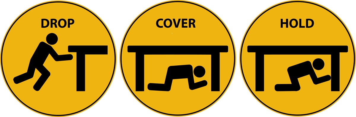
The best step in preparing a community for the inevitable major earthquake, is to ensure that its buildings are safe. The first step towards achieving resiliency is to identify buildings that are at risk of failure in an earthquake
There is a growing effort to achieve this type of resiliency, but there is still so much to be done. If you are a building owner, do your due diligence and identify the risks you and your tenants are facing.
We all know we live in earthquake country, but the quiet periods too often lull us into thinking they won’t happen – or maybe even worse – it gets us to stop thinking about them at all.
That’s when the real danger comes, because when earthquake risks are out of our minds, we stop preparing for them – and that makes everyone vulnerable.
Ali Sahabi, a licensed General Engineering Contractor (GEC), is an expert in seismic resilience and sustainability. He is Chief Operating Officer of Optimum Seismic, Inc., which has completed some 3,500 seismic retrofitting and adaptive reuse projects for multifamily residential, commercial, and industrial buildings throughout California.
[i] Los Angeles Times, “Swarm of Salton Sea earthquakes sparks worry about the San Andreas,” Aug. 10, 2020. https://www.latimes.com/california/story/2020-08-10/swarm-of-earthquakes-shakes-salton-sea-area-raising-worry-about-the-san-andreas#:~:text=Swarm%20of%20Salton%20Sea%20earthquakes,not%20ruptured%20since%20about%201680.
[ii] California Department of Conservation, Significant California Earthquakes, https://www.conservation.ca.gov/cgs/Pages/Earthquakes/Earthquakes-Significant.aspx
[iii] U.S. Geological Survey, Back to the Future on the San Andreas Fault, https://www.usgs.gov/natural-hazards/earthquake-hazards/science/back-future-san-andreas-fault?qt-science_center_objects=0#qt-science_center_objects
[iv] University of Hawaii, A model of the earthquake cycle along the San Andreas Fault System for the past 1000 years, http://www.soest.hawaii.edu/GG/FACULTY/smithkonter/research/2005JB003703.pdf
[v] University of Hawaii, A model of the earthquake cycle along the San Andreas Fault System for the past 1000 years, http://www.soest.hawaii.edu/GG/FACULTY/smithkonter/research/2005JB003703.pdf
[vi] Wikipedia, earthquakes in California, https://en.wikipedia.org/wiki/List_of_earthquakes_in_California
[vii] Nevada Appeal, How the burgeoning Walker Lane may split the American West, https://www.nevadaappeal.com/news/how-the-burgeoning-walker-lane-may-split-the-american-west/
[viii] Los Angeles Times, “Swarm of Salton Sea earthquakes sparks worry about the San Andreas,” Aug. 10, 2020. https://www.latimes.com/california/story/2020-08-10/swarm-of-earthquakes-shakes-salton-sea-area-raising-worry-about-the-san-andreas#:~:text=Swarm%20of%20Salton%20Sea%20earthquakes,not%20ruptured%20since%20about%201680.
[ix] California Earthquake Authority, https://www.earthquakeauthority.com/California-Earthquake-Risk/Faults-By-County
[x] United States Geological Survey, “Progress toward a safer future since the 1989 Loma Prieta earthquake.” https://pubs.usgs.gov/fs/2014/3092/pdf/fs2014-3092.pdf
[xi] Earthquake Engineering Research Institute, “Loss Estimates for a Puente Hills Blind-Thrust Earthquake in Los Angeles, California,” Earthquake Spectra, Volume 21, No. 2, pages 329–338, 2005. https://earth.usc.edu/files/htdocs/papers/tjordan/2005_Field_EQSpectra_LossEstimates.pdf
[xii] Straight Talk, Earthquake swarm near San Andreas fault could trigger major earthquake in California this week, https://www.straight.com/news/earthquake-swarm-near-san-andreas-fault-could-trigger-major-quake-in-california-this-week
[xiii] Live Science, How San Andreas earthquake swarms increase risk, https://www.livescience.com/56357-how-san-andreas-earthquake-swarms-increase-risk.html
[xiv] Ibid.
[xv] Mother Jones, Does fracking cause earthquakes, https://www.motherjones.com/environment/2013/03/does-fracking-cause-earthquakes-wastewater-dewatering/
[xvi] Live Science, Oklahoma’s largest earthquake on record, https://www.livescience.com/56019-oklahoma-largest-earthquake-on-record.html#:~:text=A%205.8%2Dmagnitude%20earthquake%20shook,12%3A02%3A44%20UTC.&text= The%20earthquake%20that%20shook%20Pawnee,upgraded%20the%20magnitude%20to%205.8.
[xvii] Wikipedia, 2009 L’Aquila earthquake. https://en.wikipedia.org/wiki/2009_L%27Aquila_earthquake
[xviii] Ibid. Page 243.